The JCT Traffic Signals Symposium brings together traffic signal practitioners, manufacturers, solution providers, policymakers and industry experts, maintaining a community for signal engineers.
Intelligent Transport Systems (ITS) professionals present papers and case studies to encourage an exchange of knowledge, experience and good practice.
This year's symposium addressed several topics, including traffic modelling, Intelligent Transport Systems, innovation in signal control, traffic data management, behavioural change, multimodal data, data sharing and much more.
This article highlights key takeaways from the JCT Symposium and themes local authorities and transport bodies are prioritising.

During the JCT Traffic Signals Symposium event, Darren Capes, Manager for Transport Technology Forum and Intelligent Transport Systems Policy Lead at the Department for Transport, recognised three key pillars to consider when using traffic signals to improve our transport networks.
- Better, more reliable journeys
- Promoting Active Travel
- Preparing for future technology and travel needs (data for infrastructure planning)
The fundamental principles encapsulated by these key themes resonate with the overarching objectives of the transport industry, which endeavour to reconfigure our networks in such a way that prioritises and promotes more sustainable modes of travel over the reliance on motorised vehicles. Habitually, people see the ‘car as king’, often choosing the car as a preferred mode of transport for most journeys.
In response to the global imperative for sustainability and the ambitious pursuit of net-zero targets, there is a collective drive to reshape behaviours and make sustainable travel choices the standard within our evolving transport networks.
Local councils and transportation authorities are exploring innovative solutions to enhance travel experiences, encourage active commuting, and prepare for the future. Their goal is to promote changes in behaviour and establish a holistic approach that ensures the safe and efficient coexistence of both non-motorised and motorised travel modes, benefiting all users of the transportation network.
The JCT conference highlighted some key challenges that present opportunities to improve certain aspects of managing our transport networks to enable safer, more reliable, more active journeys to enable a more sustainable future.
Integrating data for a systems approach
Core to developing how we manage and improve our networks and operations within them is data. Traffic signal systems, monitoring & evaluation and transport planning data are often not integrated, presenting challenges with communication and coordination. Similarly, in Active Travel, data can be limited or siloed for one purpose. To make informed decisions and correct investment choices, organisations rely on expertise, experience and accurate data.
Several authorities, partners and transport bodies have all recognised the need for hosted systems, providing a centralised evidence base to collect, store and analyse data together.
By integrating data, we can gain a more holistic view and better understand how the public use our networks to see where we should focus improvements and investment.
Derbyshire County Council demonstrated the value of one system integrating data from multiple sources. Rather than having multiple systems in various locations with data in various formats, they could monitor and evaluate data from multiple sources together. By doing this, councils can increase efficiencies significantly, save time and free up personnel for other projects, all while having greater confidence in the outputs.
While quantitative data remains a central focus in traffic management and transport planning, there's a growing emphasis on Active Travel. Hence, it's essential to incorporate qualitative data about people's experiences and their preferences and needs. As discussed in a previous UrbanTide article titled ‘Using the power of data to build cities of tomorrow’, it's vital to adopt a comprehensive perspective on various transport data sources. This approach provides a holistic view of trends and facilitates productive collaboration to ensure that investments in transportation improvements yield maximum benefits.
Understanding the context of people’s journeys is key to decision-making for interventions to encourage the take-up of active travel modes. Monitoring and evaluation are also crucial to understanding the benefits of these programmes and how journeys are improving. These insights can feed into wider active travel strategies and enable them to scale deployment across authorities, including at regional or national levels.
Cycling Scotland is a great example of this at a national level, learn more here!
Collaboration & open data
To facilitate a systems approach and create integrated data hubs, collaboration and open data are required. Open APIs integrate different data sets into one place and are becoming increasingly standardised to gain broader context and streamline efficiencies, often removing the need for so much hardware at the roadside. Technologies and evaluation methods have developed quickly in recent years, including, as highlighted by the Department of Transport, cooperative Intelligent Transport Systems, systems that allow users to collaborate and exchange information between roads and road users. As we continue to develop towards fully connected services, data availability, exchange, and re-use becomes increasingly crucial.
As authorities move towards new monitoring, evaluation and connection methods, they also require updated technical architecture and working methods to gain the time and resources needed. Staffordshire County Council, for instance, has underscored challenges such as resource limitations, particularly pertinent for rural authorities, and funding constraints, predominantly affecting urban councils. Some resultant recommendations aimed at liberating resources and enhancing prospects for securing funding include improving reporting mechanisms for fair allocation, enhancing asset visibility through software integration, and promoting knowledge exchange through collaborative efforts.
Open data plays a crucial role in traffic management, transport planning, and Active Travel by fostering collaboration among various authorities and partners, thereby maximising its utility beyond its initial purpose. As the demand and urgency brought about by climate change continue to rise, the imperative for infrastructure and innovation grows in tandem. To address these mounting challenges effectively, the foundation of reliable, open data becomes increasingly indispensable.
However, data is frequently confined within isolated silos, tailored for specific individual uses.
Addressing intricate problems such as improving air quality, promoting active travel, and optimising road networks relies on the principle of collaboration.
There is a need for innovative approaches in data sharing, adopting a systems-oriented framework that integrates information from multiple sources and ensures accessibility across interconnected systems. This approach is essential to guarantee that the resulting solutions are designed effectively.
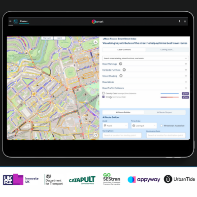
Central Bedfordshire Council are using UrbanTide’s integrated travel data insights platform, uMove, to aggregate billions of rows of data from multiple traffic sources, giving access to accurate, real-time travel data to provide an evidence base and freely share open data to accelerate Sustainability Plan targets. Learn more here.
Behavioural Change
One of the central themes to improving traffic management, transport planning, and active travel is encouraging behaviour change so the public can adopt sustainable modes and get on board with new or updated networks.
As highlighted by Rory Sutherland and Pete Dyson, authors of ‘Transport for Humans’, it is essential to consider behavioural aspects of transport and infrastructure. Authorities are beginning to consider Active Travel more in transport investment programmes. They are re-considering how Active Travel can be integrated into other programmes, such as traffic signal control systems and infrastructure updates, for equity across the public that uses them.
One type of data that can bring huge value if integrated into traffic models is pedestrian data. Authorities often have considerable amounts of data on the movement of vehicles through their networks and develop models to optimise traffic movement. However, with pedestrian optimisation integrated into traffic management, we can better understand how people move through the networks and target interventions, including active travel, to encourage a modal shift from cars to more sustainable modes.
Modal shift is a challenge within the industry as encouraging people to change their habitual behaviour requires a psychological shift. Even when presented with clear benefits, such as reduced journey time, reduced cost, improved health, etc., people are still reluctant to change their rationale as they see the ‘car as king’. With most active journeys being multi-modal, Active Travel modes and public transport need to become more attractive and convenient to the public than the car for people to consider changing habits.
Learn more about Active Travel Challenges and Solutions here.
How is uMove different?
Access & User Management: uMove is agnostic to source, allowing any data from any source to be integrated into one centralised evidence base. We treat data as data without deciding its purpose.
UrbanTide does not own the data; we facilitate data storage, analysis and sharing for use in any project or programme. Access to the uMove platform can be tailored to specific needs, with unlimited user accounts and managed functionality for role types.
Our open API enables data to be consumed by anyone, such as an internal data hub with managed access to specific teams and partners or an external open data source with open access to anyone.
Data uploading & validation: Users can access standardised data from any provider, with automated data validation to ensure quality, bespoke visualisations and report creation. We integrate additional open data sources like DfT data to enable easy report generation.
Data can be added from existing sites automatically and added for new sites at any time using site information data before validation.
Data viewing and extraction: We turn traffic operations/management data into data that can be used for any purpose, such as building business cases, modelling, annual reporting & KPIs.
Users can view a map of site locations, a calendar view of date/time data was collected, summaries of site data and insights built on context. Report generation allows users to query data and demonstrate trends.
Get in touch today to see how UrbanTide can support unlocking your digital infrastructure and data!


